Tuedsay, May 14
Dear diary,
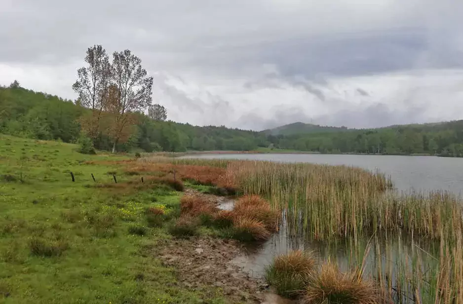
Today we started really early in the morning in order to make up for the time we lost yesterday. Our first stop was the Mânzălești locality 55 km north of Buzău city, at the border of the county. We had our eye on two lakes, Lacul Castelului and Lacul Mare (also known as Lacul Meledic), both placed on the Meledic Plateau. Once again local authorities were very supportive and we were able to take a look at the lakes. According to literature, Lacul Castelului has a surface of 3800 square meters and is 3,9 m deep, while Lacul Mare is bigger, with a surface of 7200 square meters and a maximum depth of 5,4 m.
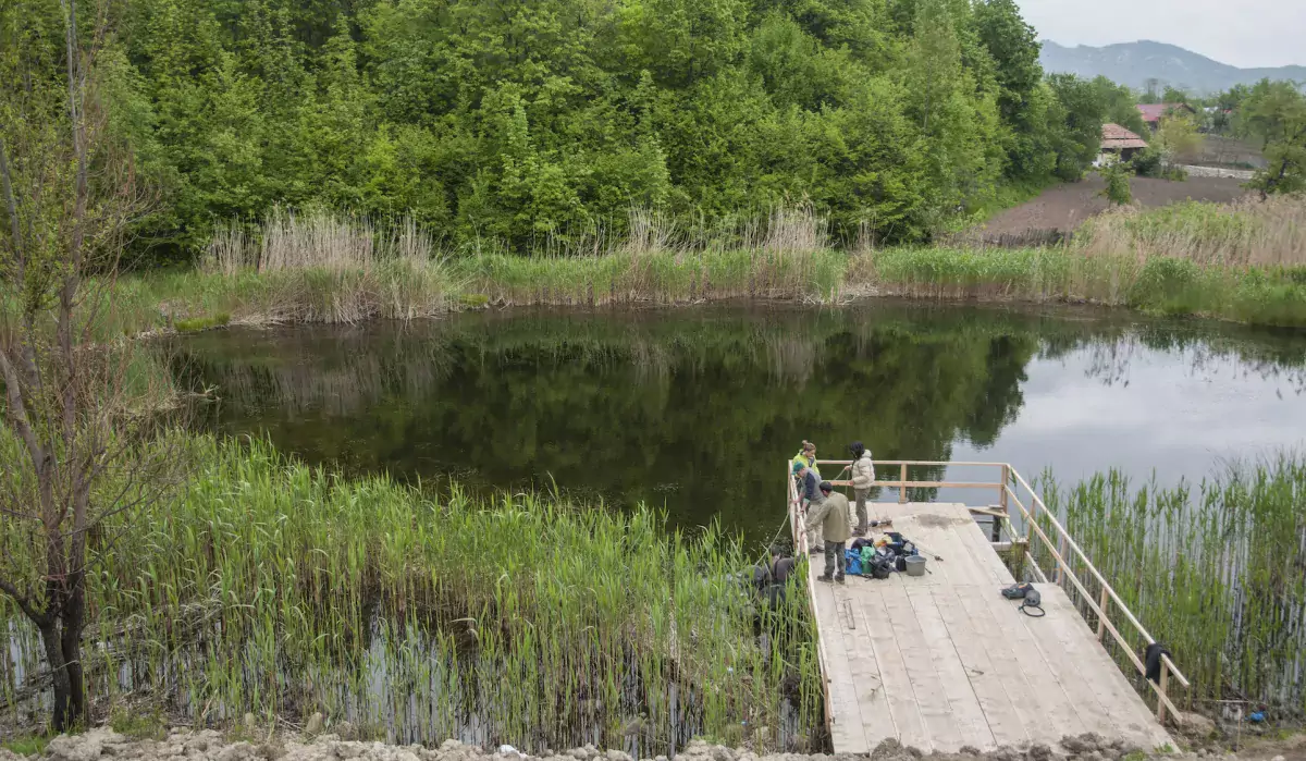
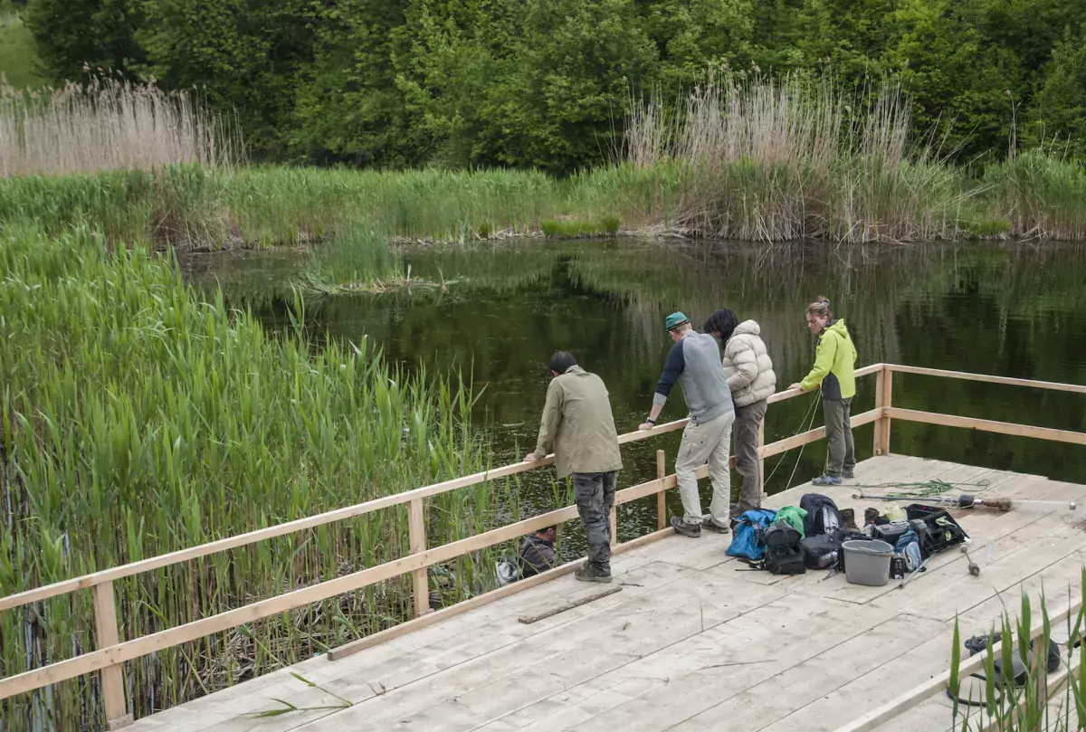
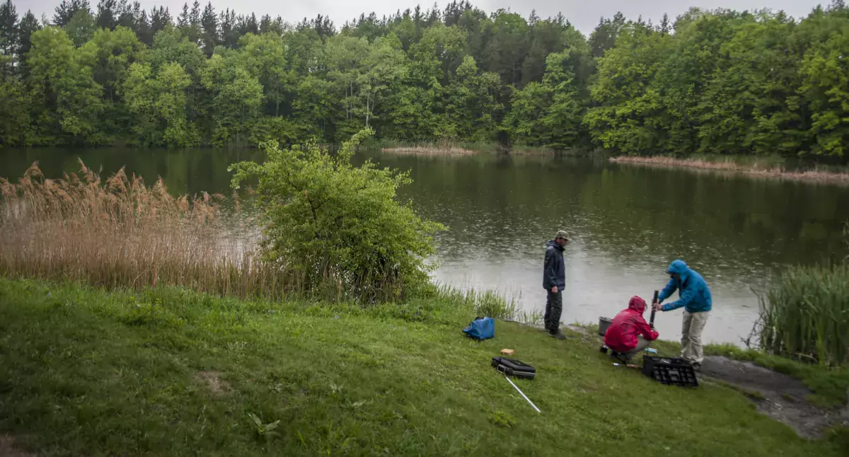
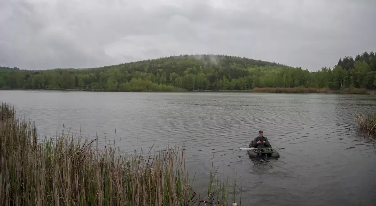
The last destination of the day was Lake Mocearu, placed in the locality of Chiliile, at 770 m altitude. It was raining and the road was quite an adventure, but our SUV’s did their job and we managed to get there. Much bigger than the other lakes we have seen, Lake Mocearu has a surface of about 10 ha. We were properly equipped and started working, but our colleague Zoltán bravely stood out in the rain for some hours without a jacket in order to handle the equipment. Amazing commitment, Zoltán!
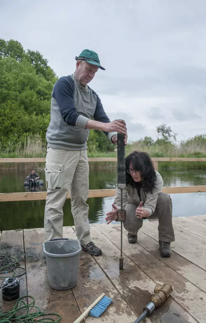
Our mission today was to recover several sediment short cores from these lakes using a Surface Gravity Corer operated from a boat. The sediments will be studied for pollen to a low resolution to obtain preliminary information about the past environment and to estimate the age of the record. Other tests will be carried out on the surface sediment samples in connection with the sampling. As part of a PhD project, it also contributes to the creation of a Chironomidae-based calibration data set. Such a database is not yet available for the Carpathian region, so it is very important to sample as many lakes as possible at different altitudes in the area, as each lake site has a different kind of environment. Once the calibration data is completed, we can understand climate and environmental change in the past more accurately.
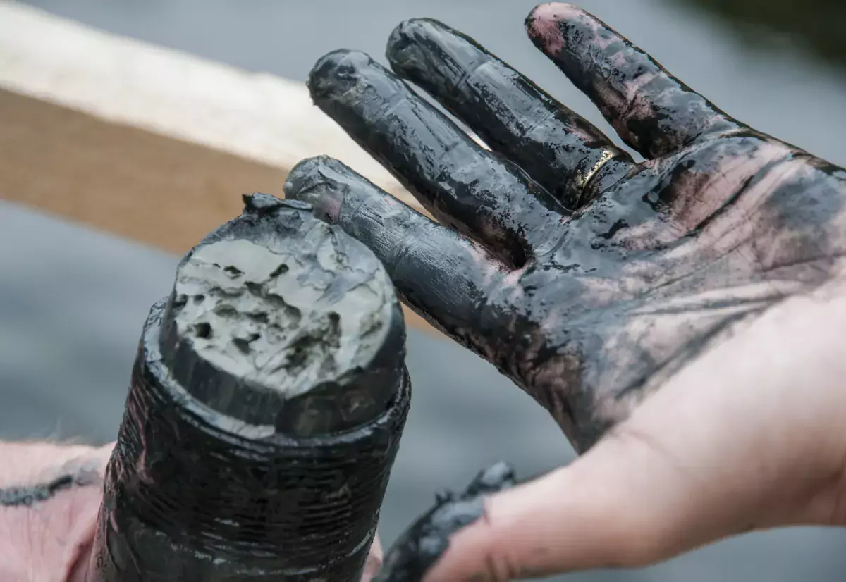
20–32 cm surface sediment was collected from all lakes and we only need the 0-3 cm section to build the database. Based on these results, we are reconstructing the past. Gray clay, which was rich in organic matter, was typical of all lake sediments. On the spot we also took surface and deep water samples, which will be evaluated later.
By the end of the day we were all exhausted, wet and dirty, but excited that we managed to see three lakes in one single day. As I already said: you never know what will happen during fieldwork!
Useful links
Literature: P. Gâștescu (1971): Lacurile din România – limnologie generală, Editura Academiei.